H2020 AMPERE
A Dedicated Solution for Electrical Power Network Maintenance and Upgrade

AMPERE

Access to electricity is a big challenge worldwide affecting 1.3 billion people. Nowadays, emerging countries are facing with a pre-existing infrastructure whose topology is not known and request new technologies to support them for maintenance and planning of new deployment. As a mid term horizon, it is planned to reduce this range to less than 1.0 billion people by 2030. In this context AMPERE consortium aims at providing an important contribution to decision-makers stakeholders, planning cost efficient maintenance and new affordable strategies in the Green Deal era.

AMPERE

Asset Mapping Platform for Emerging countries Electrification

The purpose of the AMPERE (Asset Mapping Platform for Emerging countRies Electrification) project is to provide a dedicated solution for electrical power network information gathering. AMPERE will support decision making actors (e. g. institutions and public/ private companies in charge to manage electrical network) to collect all needed info to plan electrical network maintenance and upgrade. In particular, the need for such a solution comes in emerging countries where, despite global electrification rates are significantly progressing, the access to electricity is still far from being achieved in a reliable way. Indeed, the challenge facing such communities goes beyond the lack of infrastructure assets: what is needed is a mapping of already deployed infrastructure (not known!) in order to perform holistic assessment of the energy demand and its expected growth over time. In such a context, Galileo is a key enabler -especially, considering its free-of-charge High Accuracy Service (HAS) and its highly precise E5 AltBOC code measurements- as a core component to map electric utilities, optimise decision making process about the network development and therefore increase time and cost efficiency, offering more convenient way to manage energy distribution. These aspects confer to the AMPERE project a worldwide dimension, having European industry the clear role to bring innovation and know-how to allow network intervention planning with a limited afforded financial risk above all for emerging non-European countries.
Electricity pylon
Desert Road, Namibia
High voltage tower in mountains at sunset. Electricity pylon system
The electric poles and electric lines with a sky of sunset

Context and necessity:

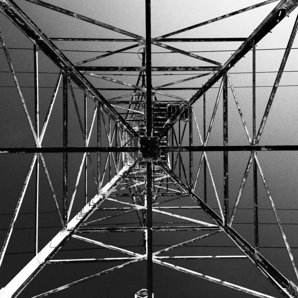
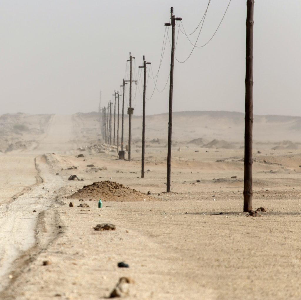
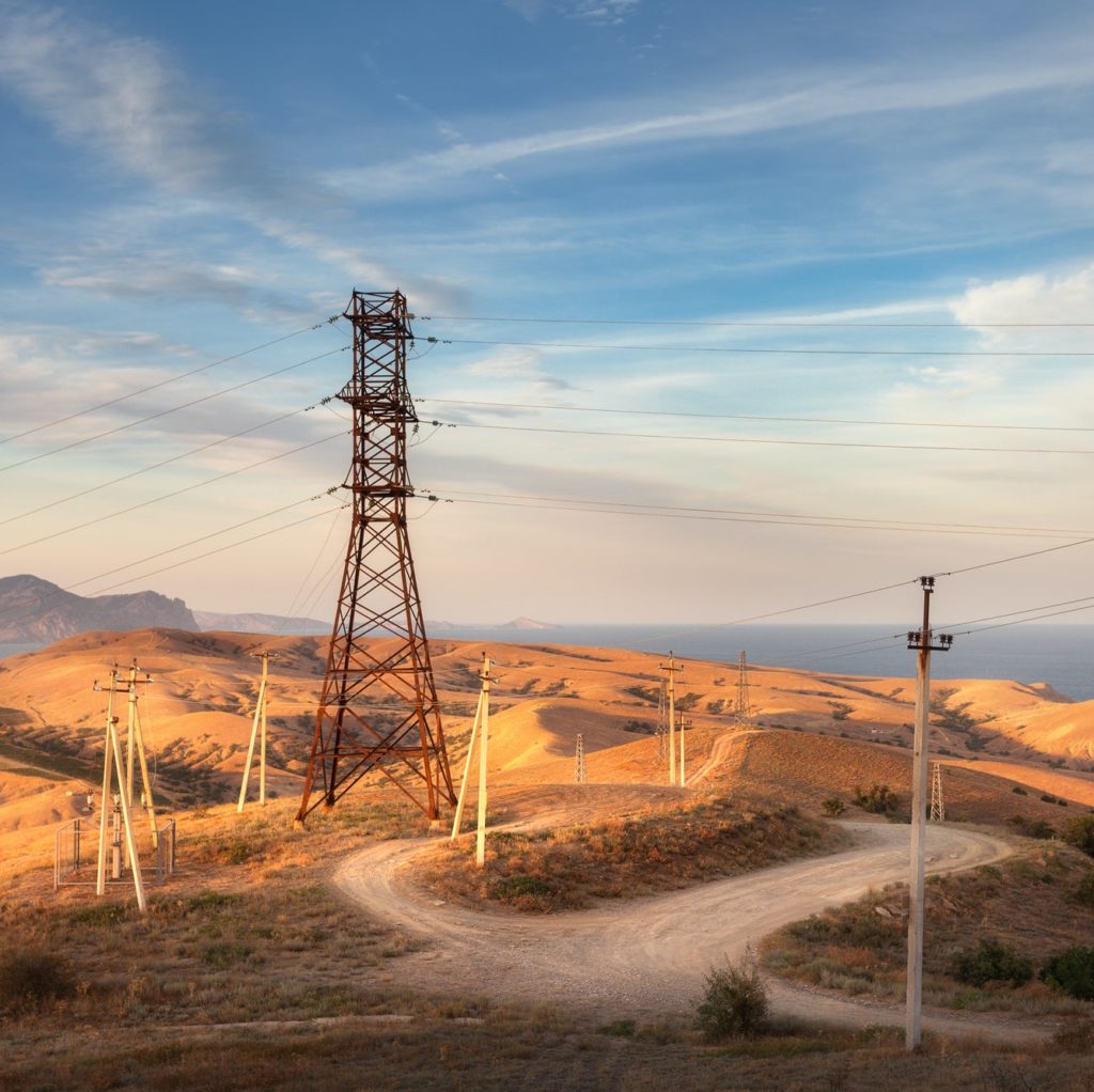
The need for network asset mapping
in emerging countries

Despite advances in overall global electrification rates, access to electricity for all is still far from achieved. The International Energy Agency (IEA) estimates that 1.2 billion people are without access to electricity, representing 17% of the global population.
As confirmed by A.R.E. (Alliance for Rural Electrification, www.ruralelec.org) in its annual report, this state of play still remains as some barriers, due to a high level of financial risk associated, prevent economies development, such as: inadequate regulation, policy gaps or uncertainty; early stage market fragmentation and unmade linkages; capacity issues and lack of standardization; lack of proven commercial business models; and lack of access to affordable longer term finance.
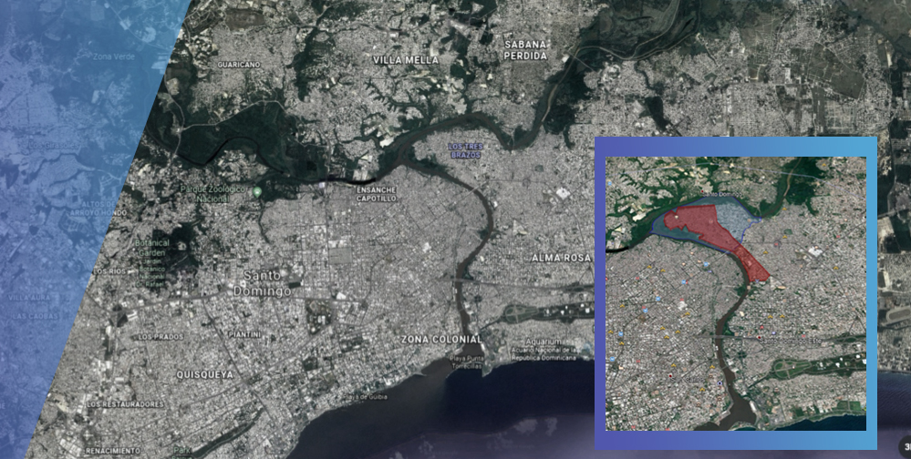
In such a scenario, it is noteworthy that, all over the world, Emerging Countries – with particular focus on Latin America, North Africa and APAC region -, are putting a huge effort into restoring historic areas in their cities, making them a first-class tourist destination.
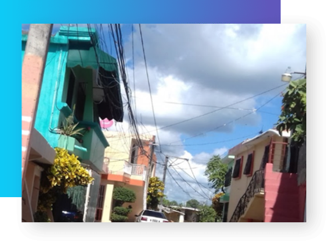
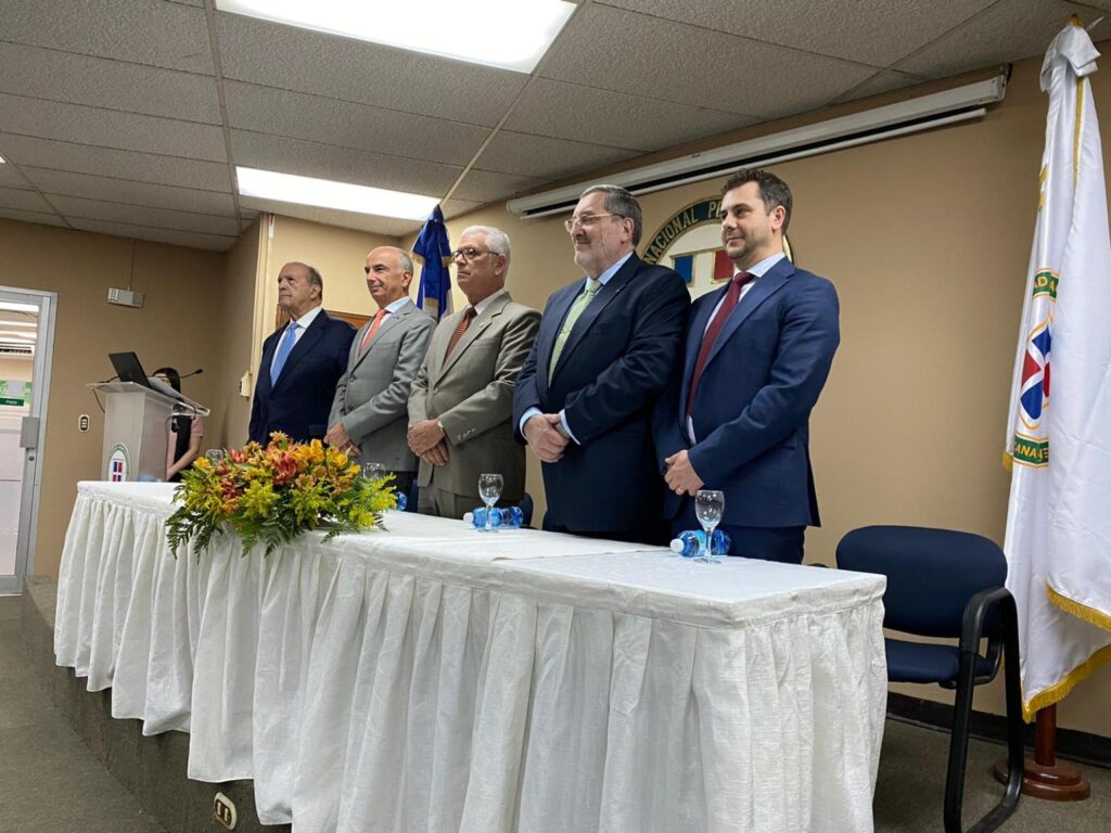
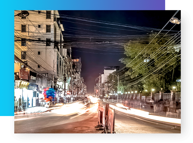
A very interesting example is the situation in the capital city of the Dominican Republic (DO), Santo Domingo, where one big problem is still constituted by power and phone lines, which are still mostly aerial, making the area somehow precarious, potentially dangerous and chaotic, taking away from the simple beauty of it.

AMPERE

Solution

AMPERE proposes a solution based on a GIS Cloud mapping technology, collecting on field data acquired with optical/thermal cameras and LIDAR installed on board a Remote Piloted Aircraft (RPA). In particular, an RPA will be able to fly over selected areas performing semi-automated operations to collect optical and thermal images as well as 3D LiDAR-based reconstruction products. Such products are post processed at the central cloud GIS platform allowing operators in planning and monitoring activities by means of visualization and analytics tools can resolve data accessibility issues and improve the decision-making process. On this context, EGNSS represents an essential technology ensuring automated operations in a reliable manner and guaranteeing high performance for both

AMPERE solution

GIS Cloud
mapping technology

3D georeferenced


points cloud built using LIDAR

01

Geo-referenced images

images using camera-independent solution by drastically reducing the needed infrastructure

02

A set of oriented geo-referenced images using camera-independent solution by drastically reducing the needed infrastructure (e.g. ground control points GCPs or other stations to provide augmentation for PVT) It is noteworthy that AMPERE approach has also other interesting use cases, in addition to electric network asset mapping. Indeed, the use of geo-referenced data analysis tools can well be extrapolated to other sectors of national life, such as: Mining, Water System, Monitoring of Forest Reserves or Parks, Search and Rescue, road systems, among others.

EGNSS

Usage as essential technology for geo referencing

AMPERE aims at exploring and exploiting Galileo advanced features -namely, High Accuracy Service (HAS) and E5 AltBOC- as a core element of the added-value asset mapping proposition. The nature of HAS is fitting very well the requirements of our application, especially due to the re-shaping of the once fee-based accuracy capability to an open, free-of-charge service delivering around 20 centimeter accuracy, versus the below-ten-centimeters PPP services, in lower convergence time.The key of Galileo HAS stands upon the high bandwidth of its E6-B channel, well suited to transmit PPP information, especially relevant for satellite clock corrections, which are not as stable in the medium and long term as the orbits. Additionally, the use of E5 AltBOC pseudo-ranges (which are cm-level precise with maximum multipath effects in the order of 1 m) supports fast ambiguity resolution for carrier phase observations.
The market is responding actively and positively to multi-frequency enhanced capabilities provided by Galileo. Around 40% of receiver models on the market are now multi-frequency. Also, in the mass market, with the launch of the world’s first dual-frequency GNSS smartphone by Xiaomi, and u-blox, STM, Intel and Qualcomm launching their first dual-frequency products earlier this year, multi-frequency is becoming a reality for user needing increased accuracy. 

Galileo HAS converges naturally within this panorama by providing PPP-level accuracies and using different frequencies for ranging measurement and high accuracy information transmission. Initial developments on GNSS receivers with E6 tracking capabilities have been carried out, which indicates a predisposition of the market to adopt Galileo HAS when available.


In summary, AMPERE aims at Galileo HAS as an optimal solution for both aerial corridor mapping and image reconstruction due to the following:

Galileo will therefore become a must-have feature in the AMPERE geo-referencing sub-system. This sub-system on-board of the RPA consist on a multi-frequency, multi-constellation GNSS receiver (including at least, L1/L2 GPS, E1/E5 Galileo) and an Inertial Measurement Unit (IMU) that will deliver a time-position-attitude trajectory to geo-reference the mapping sensors in AMPERE, that is, optical camera, thermal camera and LIDAR. We note that AMPERE will use PPP post-processing as the main baseline approach, and therefore, mitigates the risks related to potential delays or re-scheduling on Galileo E6-based HAS provision. We also note that the geo-reference subsystem will allow the generation of carried-phase differential GNSS processing and tight GNSS/IMU coupling to generate reference trajectories for validation in AMPERE.

SANTO DOMINGO

Validation Approach

Validation campaign will be conducted in Santo Domingo. The area is already selected after agreement with CDEEE: AMPERE solution will be used to map “Los Tres Brazos” sector, eastern side (ML69-02 EDEESTE) circuit.
Selected area for AMPERE validation campaign After the field campaign acquiring information (optical/thermal images and LIDAR) about the aerial electrical network and the elaboration of this information to obtain a map of the network itself, a check of the results performed by AMPERE is necessary by providing comparisons with current state of the art approaches. In particular, UNPHU (having a large experience in the use of GNSS receivers in geomatics applications, such as electronic cadaster, cartography, geo-referencing of images from satellites and RPAs) will lead the validation activity: UNPHU will perform a more conventional campaign, based on GNSS receivers for geomatics applications and visual inspection of the electric infrastructure. The “manually” acquired data will be processed with a GIS software to obtain a map of the surveyed area. The comparison of the results obtained with the two different approaches, also taking into account the time necessary for getting the results, will give a good measure of the effectiveness of the new approach.

AMPERE consortium

Free Soft and Tech s.r.l.

Founded in 2007 as a captive operator in the Italian deregulated electricity market, Today, the Free Group is an independent operator in the mid-stream energy markets (sourcing, transport, storage) and down-stream (supply of energy commodities, all-round savings and efficiency solutions, IT services). In terms of economic and financial performance, the Free Group is one of the most solid players of the energy sector in the Italian market, with a business model that first of all enhances the relationship with the customer and pivots on cash generation and sound risk management. Free Group as a PORTFOLIO OF OVER 60,000 CUSTOMERS Over the next three years, Gruppo Free wants to become a key player in the energy market in Italy, establishing itself as an all-round operator for the services and solutions of Energy Efficiency and Saving and high-end Energy Management

AMPERE consortium

Gruppo Sistematica

Sistematica S.p.A. is a more than 20 years experienced in the design and development of complex and integrated SOFTWARE solutions. Highly skilled resources for real-time and distributed systems, big data analytics and specific algorithms implementation work in 3 software farms for turn-key projects development and delivery and offer specific competence for mobility, telematics, aerospace and energy management. Specialties: Aerospace | TELCO | Telematics & Connectivity | Automation & Control | Business Support Systems | Energy Management | Document & Workflow Management | Form Processing | Cybersecurity | Big Data | Data Analytics | Cognitive Computing | ICT solutions for energy management | Firmware, Process Automation | Smart Grids | Energy Saving | Advanced Algorithms

AMPERE consortium

GeoNumerics

GeoNumerics (Castelldefels, Spain, since 2002) is a small team with a long experience dedicated to geomatics. Its mission is to develop state-of-the-art geomatic technology. GN provides consultancy services, markets software components and conducts research-and-development (R&D) projects. GeoNumerics is an intensive R&D company. GeoNumerics focuses on the needs and technology of high precision navigation and kinematic surveying; sensor orientation and calibration, trajectory determination and their integration. Its knowledge base includes: years of experience in SW development for geomatic applications; fundamental geomatics technology; numerical algorithm design; network modelling and adjustment; precise geodetic positioning with GNSS and INS/GNSS for airborne photogrammetry and remote sensing applications; and single- and multi-sensor navigation/orientation/calibration: frame/line cameras and airborne/mobile LiDAR

AMPERE consortium

University of Naples "Federico II"

The University of Naples “Federico II” (UNI-NA) is one of the oldest academic institutions in the world having been founded by Frederick II Hohenstaufen, King of Sicily and Head of the Roman Empire, in 1224. The former Faculty of Engineering is one of the oldest and largest in Italy, with about 13000 students with almost all engineering branches and graduates about 1000 engineers each year. The Department of Industrial Engineering was established in 2013 by incorporating academic staff from former Departments of Aerospace Engineering, Management Engineering, Naval Engineering, Energy and Applied Thermal Fluid Dynamics. Research in the aerospace sector has a long tradition dating its roots back in 1926, when the Laboratory of Aeronautical Structures was established by Gen. Prof. Umberto Nobile, famous designer, pilot of airships and polar explorer. The Aerospace Systems team relies on eight staff members, post-doc researchers, PhD students, young graduate and undergraduate students. The team has conducted aerospace research programs related to several aspects of aerospace research. UAS research includes topics such as: Sense and Avoid and UAS integration in the airspace (ATM and UTM/U-Space), cooperative UAV swarms, autonomous navigation and flight with emphasis on complex and/or GNSS-challenging/denied environments, and innovative sensing systems for small UAS including LiDAR and ultralight radars

AMPERE consortium

Bip

Business Integration Partners (BIP) was founded in 2003 as a spin-off from one of the major consulting firms worldwide; today it is recognised as one of the largest players in the European management consulting business. Fifteen years after its foundation, with more than 3.300 professionals worldwide, and an annual consolidated turnover exceeding € 240 million, BIP is regarded as a true success story in European strategy and management consulting and as an ideal business advisor for its quality, innovation, efficiency, expertise in modernisation and development, delivered to large Companies, Public Institutions and EU Bodies and Agencies BIP has evolved in a large Group and developed a major global network: with several offices across Europe (Rome, Milan, London, Brussels, Madrid, Lisbon), North America, South America, Africa and Middle East, BIP can support its clients globally. BIP has also established strategic and operational partnerships to cover all major markets in the world. BIP possesses distinctive capabilities in designing and realising tangible consulting projects, merging coherently Clients’ strategic vision, business model, and operational deployment, while fully preserving their corporate culture. BIP consultants are recognised for wide business knowledge, reliability and superior capacity to deliver tailor-made solutions for performance improvements. In the last few years, BIP is increasing its footprint in the Space domain, acquiring heterogeneous projects and professional profiles bringing knowledge of the space sector, recognising the rising importance that this domain represents both for national and international institutions and for the civil society

AMPERE consortium

TopView SRL

TopView SRL is a SME limited company in the form of “innovative start-up” founded in 2013 to explore the new growing market of remote piloted aircraft systems (RPAS); its mission is focused on study, research and development of autonomous and remoted piloted robots for aerial, maritime and terrestrial applications. The company’s vision is to use the RPAS technology to add value to traditional productive sectors, according to safety of operations, privacy of data collected during the acquisition campaigns in compliance with actual regulations of National Aviation Authority (ENAC). In this context, TopView is an active member of ASSORPAS, an Italian association registered in CONFINDUSTRIA that gathers companies operating in the sector of small unmanned aircraft, interceding the relationship with the institutional world. The Innovative products of TOpView include tailored solutions to enhance flight time (e.g. tethered multicopter solutions for unlimited flight time operations), VIS-TIR sensors customized for energy niches services and IOT sensors for general purpose applications. The main application markets spread from Energy domain (drone systems for automating maintenance operations of large photovoltaic plants), to IoT services realized through innovative high endurance sensors and smart communication links, as Public Narrow Band-LTE and Private LoRaWAN wireless networks. TopView business derives from products and services generated by the R&D activities in both Aerospace and IoT domain; the offered services include the consultancy offered to several niche markets and competence areas as Energy, Search&Rescue, Agriculture, Construction, Automotive, Medicine (some of the logos below have been filed as trademarks).

AMPERE consortium

Unphu

Universidad Nacional Pedro Henriquez Ureña (UNPHU) was founded on April 21st, 1966 by a distinguished group of professors, with a brilliant and continual trajectory. This allows being one of the most prestigious centers of superior education in the country. Is the first private university in DR. Nowadays UNPHU count with a vast experience in the research field investigation in waste management, environment and natural resources management, renewable energy, architecture, civil engineering, among other. The name of Pedro Henriquez Ureña chosen to denominate the University is a tribute and acknowledgement to such great Dominican philologist and humanist, glory of the letters in America and in the world. Currently the University is located on its new a modern campus, where gradually has been extending their dependencies, in accordance with the requirements of the development of their academic programs and the increase of its student enrollment. For the development of the teaching and administrative activities the University has the facility of Santo Domingo, an Agricultural and Cattle rising facility in Nigua, in San Cristobal and an extension of the university in La Vega. SANTO DOMINGO CAMPUS. The campus E. O. Garrido Puello, located in John F. Kennedy Ave. Km 6 ½ in Santo Domingo has an area of 195,000 square meters and 22,052 meters of construction. Composed by 11 buildings